Activities
From 2002 to 2012, we provided assistance to experts or end-users specifically in weather radar data utilisation, in different task:
- Consulting: assistance to end-users for the definition of operational applications, data selection, test of facilities management strategies.
- Studies in operational context: analysis of radar data quality, data re-analysis, optimisation of the data use.
- Operational application: assistance for the building of operational tools, integration of radar data in existing tools and uses.
- R&D: R&D studies, transfer of research results to operational use, software optimisation, interface between researchers and end-users.
Thematic information
Precipitation forecasting and nowcasting:
Here, some
indications concerning the limits and the good use of radar forecasting
(in French).
Download papers:
Here, you have access to a list of personal papers published in the field.
Weather Links:
On line access to radar and weather information in France, in Europe, or in the world.
French vigilance maps in real time
|

Weather Vigilance
© Météo-France
|

Flooding Vigilance
(source SCHAPI)
|

European Vigilance
(source Eumetnet)
|
|
References
Below are some examples of achievements for partners who trusted us:

|
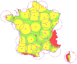
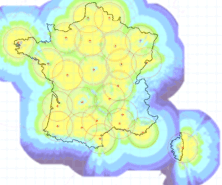
To simulate the hydrologic visibility of the French weather radar network
|
|
By exploiting research results of the
LTHE,
ALICIME developed an operational version of a software package simulating the
measurement quality of a weather radar. This software is now utilised by Météo-France.
|
|
We have used an upgraded version of this
tool in 2005 and 2006 to assess the hydrologic visibility of the French
network of 24 weather radars controlled by Météo-France. In 2007 we
proposed an optimal volumetric measurement protocol for each of the
24 radars of the ARAMIS network.
|
To use radar data for the optimisation of
process management
|
Quantitative precipitation estimation (QPE) or
forecasting (QPF), quantitative or qualitative alert criterions, we have
developed customised operational software which can be integrated in existing management
systems of services or industrial processes.
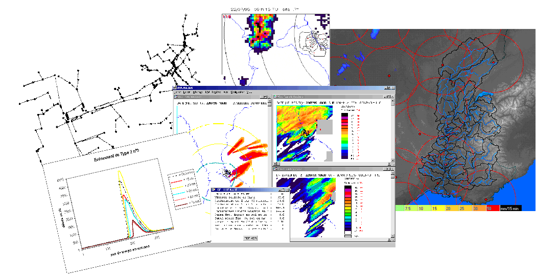
For example, ours tools
are used by the Urban Community of Nancy (NE France, 270 000 inhabitants)
to optimise the security and the efficiency of its sewage system management
in rainy weather, and by the "Compagnie Nationale du Rhône" in order
to improve its forecasts of the Rhône river flow and the electricity
production of its 19 hydropower plants.
|
To detect and monitor intense rain cells
|
Radar data are decisive for the storm alert and
for the real time management of rain events. ALICIME has developed operational
tools in this field, which can be integrated in the existing survey
systems of the end-users.
We have a specific expertise of rainy water
management in urbanised area, and developed the storm alert system of
the Urban Community of Nancy.
|
To analyse historical rain events
|
Radar archives can be used to analyse particular
rain events or to realise a climatological study with large sets of
data. The animation of radar images and their spatial coverage allow
to understand the evolution of the rain events.
We have realised many studies or we have proposed
customised software adapted to each requirements.
|