Simulation of the hydrologic visibility of the ARAMIS radar network
§ Objective
To estimate by simulation and to optimise the quality of the spatial coverage of the French weather radars network (The ARAMIS network) for rainfall measurement (called "hydrologic visibility of the radars").
The work consisted in quantitatively simulating the effects on rainfall measurement, of ground echoes, masks induced by relief, anthropogenic masks (trees, buildings), and of the vertical variations of the radar reflectivity. These simulations take into account several types of vertical profile of reflectivity, various types of processing of the volume scans for each radar, and the complementarity of the spatial coverages of the 24 radars (network at the end of 2007).
This work was part of the actions carried out to develop the geographic coverage and to improve the quality of the ARAMIS measurements (The ARAMIS network is operated by Météo-France). The simulations use results of the research work of the LTHE (University of Grenoble, France).
§ Partners
Météo-France
The Laboratoire d'étude des Transferts en Hydrologie et Environnement (LTHE)
The Service Central d'Hydrométéorologie et d'Appui à la Prévision des Inondations (SCHAPI)
§ Results
This work was completed in three stages. The first stage allowed to estimate the measurement quality of the ARAMIS network in the south-east France, and the variability of this quality for a VPR climatology provided by the LTHE (presentation in French: pdf 2.7Mo). The second stage extended the simulation to the whole ARAMIS network for few models of VPR for the France Country. The third stage was the optimisation of the volumetric scanning of each radar in order to have an hydrologic visibility quality close the maximum achievable for each radar. This hydrological volumetric scanning, using only 2, 3 or 4 elevation angle by radar, authorise to use other elevation angles for other purposes.
A Great number of visibility map simulated for all the radar network allow to compare improvements linked to different radar scanning, and to different data merging of the measurements realised at the different elevation angles.
|
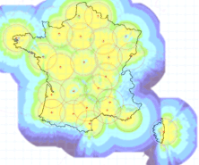
Exemple of visibility map of the ARAMIS network for a mean French VPR. Contact Météo-France for more information on the hydrologic visibility of the ARAMIS network. |
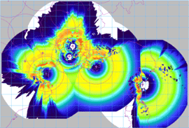
Analysis example of the temporal variability of the hydrologic visibility for 5 radars in the SE of France, for a set of more than 200 regional hourly VPR (blue=low variability, yellow=strong variability, orange=very strong). |
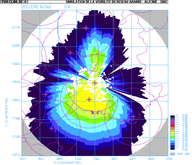
Example of the reduction of the hydrologic visibility of a radar as the elevation angle increases. |
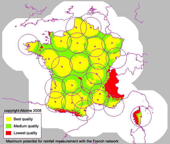
A particular result is the estimation of the maximum potential of measurement with the current ARAMIS network of 24 weather radars, with the use of a total scanning of the atmosphere protocol. The picture below show the spatial variation of this maximum in France. (Warning: this map doesn't describe the quality of all the radar products in France at the present, but show a representation of the relative variation in quality of the radar rainfall estimations in France, with the best volumetric measurements and the best radar data processing)